Dere Street – Römische Straße von York zur Antoninermauer (A1/A68)
Dere Street – historische römische Straße von York zur Antoninermauer: Spur der A1/A68, antike Route durch Deira. Entdecken Sie römische Relikte und Kulturgeschichte.
Die Dere Street (später Via Regia in Schottland) war eine römische Straße in Großbritannien. Sie verlief zwischen Eboracum (York) und der Antoninermauer bei Bo'ness (Veluniate) im heutigen Schottland.
Die Dere Street existiert immer noch als Route der Hauptstraßen, einschließlich der A1 und A68 nördlich von Corbridge.
Sein Name stammt aus dem nachrömischen angelsächsischen Königreich Deira, durch das der erste Teil seiner Route verläuft. Sie wurde manchmal auch als "Watling Street" bezeichnet und auf einigen Karten als solche markiert. Dies kann dazu führen, dass sie mit der Watling-Straße verwechselt wird, die Dover mit Wroxeter verband.
Bildergalerie
10 Bilder


Geschichte und Zweck
Die Dere Street wurde in römischer Zeit als wichtige Militär- und Versorgungsstraße angelegt. Sie verband das große Legionärs- und Verwaltungszentrum Eboracum (York) mit den Forts und Grenzanlagen im Norden Britanniens und führte bis zur Antoninermauer in Zentral-Schottland. Solche Straßen dienten dem raschen Truppentransport, der Versorgung von Garnisonen und der Verwaltung des römischen Herrschaftsgebiets.
Bauweise und archäologische Spuren
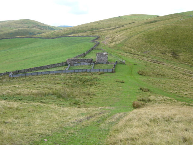
Typisch für römische Straßen sind ein erhöhter Straßenkörper (agger), gut entwässerte Schichten mit festem Belag und seitliche Gräben. Von der Dere Street sind an verschiedenen Stellen noch Reste des Agger, von Metallschichten, Brückenfundamenten und Meilensteinen nachweisbar. Archäologische Ausgrabungen an Orten wie Corbridge und mehreren Kastellen entlang der Strecke haben Zeugnisse römischer Infrastruktur, Kavallerie- und Infanterieanlagen sowie Lagerstätten zu Tage gefördert.
Verlauf und bedeutende Stationen
- Ausgangspunkt war Eboracum (York), ein zentraler Militär- und Verwaltungsknotenpunkt.
- Weiter nördlich führte die Straße durch Gebiete mit zahlreichen römischen Kastellen und Wachposten; entlang der Route liegen bekannte Fundstellen und ehemalige Militärlager.
- Im Norden endete die Straße an der Antoninermauer bei Bo'ness (Veluniate), die kurzzeitig die nördliche Grenze des römischen Einflusses markierte.
Die genaue Trasse der Dere Street weicht an einigen Stellen von modernen Straßen ab, doch an vielen Abschnitten sind Parallelen erkennbar. Heute folgen Teile moderner Verkehrswege den alten Linien – dazu gehören Abschnitte der A1 und insbesondere die A68 nördlich von Corbridge, wie bereits erwähnt.
Name und Nachnutzung
Der Name "Dere Street" leitet sich vom angelsächsischen Königreich Deira ab, durch das der südliche Teil der Straße führte. In schottischen Quellen wurde sie später oft als Via Regia bezeichnet. Wegen historischer Kartierungen und lokaler Bezeichnungen kam es bisweilen zu Verwechslungen mit der Watling-Straße, die eine andere römische Hauptverbindung darstellt.
Heutiger Zustand, Schutz und Besucherhinweise
Teile der Dere Street sind heute noch als Fuß- und Feldwege sichtbar; andere Abschnitte sind in moderne Straßen integriert oder überbaut. Archäologische Denkmalpflege bemüht sich, freigelegte Reste zu dokumentieren und zu schützen. Wer Überreste römischer Straßen und Kastelle sehen möchte, kann viele Fundstellen besuchen – besonders lohnend sind Orte mit Museumseinrichtungen oder Informationsschildern, etwa die Ausgrabungen und Sammlungen in der Region Corbridge und in Museen in York.
Forschung
Die Trasse und Bedeutung der Dere Street wurden durch historische Quellen, Karten und zahlreiche archäologische Untersuchungen rekonstruiert. Dennoch bleiben an einigen Stellen Unsicherheiten über genaue Linienführungen und Nebenzweige, weshalb Kartierungen und Grabungen weiterhin wichtige Beiträge zum Verständnis dieser römischen Verkehrsader leisten.
Zusammengefasst: Die Dere Street war eine strategisch bedeutende römische Straße von Eboracum bis zur Antoninermauer, deren Spuren bis heute in Landschaft und Infrastruktur nachwirken. Sie bleibt ein wichtiges Objekt der historischen Forschung und ein attraktives Ziel für Besucher, die römische Überreste sehen möchten.
Fragen und Antworten
Q: What is Dere Street?
A: Dere Street is a Roman road in Britain that ran between Eboracum (York) and the Antonine Wall at Bo'ness (Veluniate), in what is now Scotland.
Q: Does Dere Street still exist?
A: Yes, Dere Street still exists as the route of major roads, including the A1 and A68 just north of Corbridge.
Q: Where does the name "Dere Street" come from?
A: The name "Dere Street" comes from the post Roman Anglo-Saxon kingdom of Deira, through which the first part of its route lies.
Q: Was Dere Street ever referred to as "Watling Street"?
A: Yes, Dere Street was sometimes referred to as "Watling Street" and marked on some maps as such.
Q: What can cause Dere Street to be confused with another road?
A: Dere Street can be confused with the Watling Street that linked Dover with Wroxeter because it was sometimes marked on maps as "Watling Street."
Q: What major roads follow the route of Dere Street today?
A: The A1 and A68 major roads follow the route of Dere Street today, just north of Corbridge.
Q: What two cities did Dere Street connect?
A: Dere Street connected Eboracum (York) and the Antonine Wall at Bo'ness (Veluniate), in what is now Scotland.
Verwandte Artikel
Autor
AlegsaOnline.com Dere Street – Römische Straße von York zur Antoninermauer (A1/A68) Leandro Alegsa
URL: https://de.alegsaonline.com/art/26760