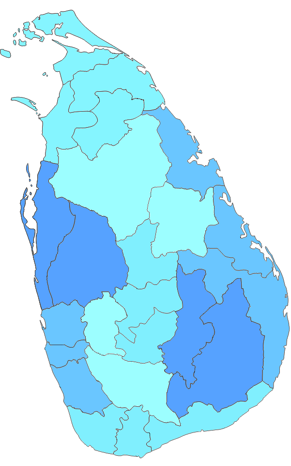
Distrikte in Sri Lanka: Übersicht, Verwaltung und Gliederung (25 Distrikte)
Komplette Übersicht zu Sri Lankas 25 Distrikten: Verwaltung, Gliederung, Provinzzuordnung und Zuständigkeiten – klar, aktuell und informativ für Planer und Reisende.
In Sri Lanka sind die Distrikte (Singhalesisch: දිස්ත්රික්ක, Tamilisch: மாவட்டம்) die Verwaltungsabteilungen der zweiten Ebene. Die erste Ebene sind die Provinzen. Jede Provinz enthält eine Anzahl von Distrikten. Es gibt 25 Distrikte im Land. Sie sind in 9 Provinzen organisiert. Jeder Distrikt wird von einem Distriktsekretär verwaltet. Die Sekretäre werden von der Zentralregierung ernannt.
Bildergalerie
8 Bilder


Organisation und Verwaltung
Die Distrikte sind primär administrative Einheiten der Zentralregierung. Sie dienen der Koordination staatlicher Leistungen vor Ort und sind Bindeglied zwischen der zentralen Verwaltung und den untersten Verwaltungsebenen. Jeder Distrikt verfügt über ein Distriktsekretariat (auch früher als Government Agent bzw. GA bezeichnet), dessen Leiter der Distriktsekretär ist. Dieser leitet die Umsetzung nationaler Programme, überwacht öffentliche Dienste und koordiniert Katastrophenschutzmaßnahmen.
Aufgaben des Distriktsekretärs
- Koordination und Umsetzung nationaler Politik auf Distriktebene
- Verwaltung von Land- und Katasterangelegenheiten in Zusammenarbeit mit zuständigen Behörden
- Leitung von Katastrophen- und Notfallmaßnahmen
- Kooperation mit Provinzbehörden und lokalen Selbstverwaltungen (Municipal Councils, Urban Councils, Pradeshiya Sabhas)
- Unterstützung von Entwicklungsprojekten und Verteilung staatlicher Mittel
- Aufsicht über administrative Untergliederungen wie Divisional Secretariats und Grama Niladhari
Untergliederung innerhalb der Distrikte
Ein Distrikt ist weiter unterteilt in Divisional Secretariats (häufig als DS-Divisionen bezeichnet), die wiederum in kleinere Einheiten, die Grama Niladhari-Gebiete (Dorfbeamtenbereiche), gegliedert sind. Parallel zur zentralen Verwaltungsstruktur existiert die lokale Selbstverwaltung mit Municipal Councils (für größere Städte), Urban Councils und Pradeshiya Sabhas (für ländliche Bereiche), die lokale Dienstleistungen und kommunale Aufgaben übernehmen.
Liste der Distrikte nach Provinzen (25 Distrikte)
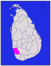
- Western Province: Colombo, Gampaha, Kalutara
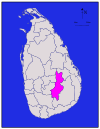
- Central Province: Kandy, Matale, Nuwara Eliya
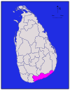
- Southern Province: Galle, Matara, Hambantota
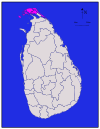
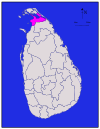
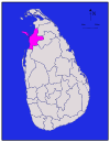
- Northern Province: Jaffna, Kilinochchi, Mannar, Vavuniya, Mullaitivu
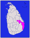
- Eastern Province: Trincomalee, Batticaloa, Ampara
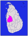
- North Western Province: Kurunegala, Puttalam
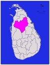
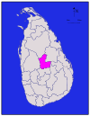
- North Central Province: Anuradhapura, Polonnaruwa
- Uva Province: Badulla, Moneragala
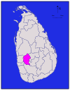
- Sabaragamuwa Province: Kegalle, Ratnapura
Historischer Hintergrund
Die heutige Distriktseinteilung geht teilweise auf Verwaltungsreformen während der britischen Kolonialzeit zurück; seit der Unabhängigkeit wurden Grenzen und Zuständigkeiten mehrfach angepasst, die grundlegende Struktur mit Provinzen und Distrikten blieb jedoch erhalten. Mit der Schaffung der Provinzräte (Provincial Councils) im Rahmen der Dezentralisierung wurden bestimmten Provinzbehörden Zuständigkeiten übertragen, die Distrikte blieben jedoch wichtige operative Einheiten der zentralen Verwaltung.
Besonderheiten und Statistik
Die Distrikte unterscheiden sich stark hinsichtlich Fläche, Bevölkerungsdichte, wirtschaftlicher Struktur und Infrastruktur. So ist der Distrikt Colombo das wirtschaftliche Zentrum mit hoher Bevölkerungsdichte, während z. B. Mullaitivu oder Mannar dünner besiedelt und ländlich geprägt sind. Distrikte spielen außerdem eine wichtige Rolle bei Wahlen, der Durchführung staatlicher Programme und bei Entwicklungsplanungen.
Zusammenfassung
Die 25 Distrikte Sri Lankas sind die zentrale Ebene für die praktische Verwaltung durch die Zentralregierung. Über Distriktsekretariate und ihre Untereinheiten wird die Umsetzung staatlicher Aufgaben vor Ort organisiert, während Provinz- und Lokalbehörden ergänzende und teilweise selbstverwaltende Aufgaben übernehmen.
Distrikte
Alle Bevölkerungszahlen stammen aus der letzten Volkszählung in Sri Lanka im Jahr 2012. Die Bevölkerungsdichte wurde anhand der Landfläche und nicht anhand der Gesamtfläche berechnet (die Gesamtfläche hätte die Fläche der Flüsse und Seen umfasst).
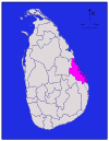
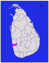
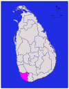
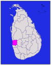
| Bezirk | Karte der Umgebung | Provinz | Bezirkshauptstadt | Landareain | Inlandwasserfläche | Gesamtfläche | Bevölkerung | Bevölkerungsdichte pro |
| Ampara |
| Ampara | 4,222 (1,630) | 193 (75) | 4,415 (1,705) | 648,057 | 153 (400) | |
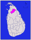
| Anuradhapura |
| Nord-Zentral | Anuradhapura | 6,664 (2,573) | 515 (199) | 7,179 (2,772) | 856,232 | 128 (330) |
| Badulla |
| Uva | Badulla | 2,827 (1,092) | 34 (13) | 2,861 (1,105) | 811,758 | 287 (740) |
|
| Batticaloa | 2,610 (1,010) | 244 (94) | 2,854 (1,102) | 525,142 | 201 (520) | ||
| Colombo |
| Westlich | Colombo | 676 (261) | 23 (8.9) | 699 (270) | 2,309,809 | 3,417 (8,850) |
| Galle |
| Südlich | Galle | 1,617 (624) | 35 (14) | 1,652 (638) | 1,058,771 | 655 (1,700) |
| Gampaha |
| Westlich | Gampaha | 1,341 (518) | 46 (18) | 1,387 (536) | 2,294,641 | 1,711 (4,430) |
| Hambantota |
| Südlich | Hambantota | 2,496 (964) | 113 (44) | 2,609 (1,007) | 596,617 | 239 (620) |
|
| Nördlich | 929 (359) | 96 (37) | 1,025 (396) | 583,378 | 628 (1,630) | ||
| Kalutara |
| Westlich | Kalutara | 1,576 (608) | 22 (8.5) | 1,598 (617) | 1,217,260 | 772 (2,000) |
| Kandy |
| Kandy | 1,917 (740) | 23 (8.9) | 1,940 (750) | 1,369,899 | 715 (1,850) | |
| Kegalle |
| Sabaragamuwa | Kegalle | 1,685 (651) | 8 (3.1) | 1,693 (654) | 836,603 | 497 (1,290) |
|
| Nördlich | Kilinochchi | 1,205 (465) | 74 (29) | 1,279 (494) | 112,875 | 94 (240) | |
| Kurunegala |
| Kurunegala | 4,624 (1,785) | 192 (74) | 4,816 (1,859) | 1,610,299 | 348 (900) | |
|
| Nördlich | Mannar | 1,880 (730) | 116 (45) | 1,996 (771) | 99,051 | 53 (140) | |
| Matale |
| Matale | 1,952 (754) | 41 (16) | 1,993 (770) | 482,229 | 247 (640) | |
| Matara |
| Südlich | Matara | 1,270 (490) | 13 (5.0) | 1,283 (495) | 809,344 | 637 (1,650) |
| Moneragala |
| Uva | Moneragala | 5,508 (2,127) | 131 (51) | 5,639 (2,177) | 448,142 | 81 (210) |
|
| Nördlich | Mullaitivu | 2,415 (932) | 202 (78) | 2,617 (1,010) | 91,947 | 38 (98) | |
| Nuwara Eliya |
| Nuwara Eliya | 1,706 (659) | 35 (14) | 1,741 (672) | 706,588 | 414 (1,070) | |
| Polonnaruwa |
| Nord-Zentral | Polonnaruwa | 3,077 (1,188) | 216 (83) | 3,293 (1,271) | 403,335 | 131 (340) |
| Puttalam |
| Puttalam | 2,882 (1,113) | 190 (73) | 3,072 (1,186) | 759,776 | 264 (680) | |
| Ratnapura |
| Sabaragamuwa | Ratnapura | 3,236 (1,249) | 39 (15) | 3,275 (1,264) | 1,082,277 | 334 (870) |
|
| Trincomalee | 2,529 (976) | 198 (76) | 2,727 (1,053) | 378,182 | 150 (390) | ||
|
| Nördlich | Vavuniya | 1,861 (719) | 106 (41) | 1,967 (759) | 171,511 | 92 (240) | |
| Gesamt | 62,705 (24,211) | 2,905 (1,122) | 65,610 (25,330) | 20,263,723 | 323 (840) |


Fragen und Antworten
Q: What are districts in Sri Lanka?
A: In Sri Lanka, districts are the second-level administrative divisions.
Q: What is the first level of administrative divisions in Sri Lanka?
A: The first level of administrative divisions in Sri Lanka are the provinces.
Q: How many districts are there in Sri Lanka?
A: There are 25 districts in Sri Lanka.
Q: How many provinces are there in Sri Lanka?
A: There are 9 provinces in Sri Lanka.
Q: Who administers each district in Sri Lanka?
A: Each district in Sri Lanka is administered under a District Secretary.
Q: Who appoints the District Secretaries in Sri Lanka?
A: The central government appoints the District Secretaries in Sri Lanka.
Q: What are the names of the administrative divisions used in Sinhala and Tamil in Sri Lanka?
A: The administrative divisions in Sri Lanka are known as "දිස්ත්රික්ක" in Sinhala and "மாவட்டம்" in Tamil.
Verwandte Artikel
Autor
AlegsaOnline.com Distrikte in Sri Lanka: Übersicht, Verwaltung und Gliederung (25 Distrikte) Leandro Alegsa
URL: https://de.alegsaonline.com/art/27771
Quellen
- commons.wikimedia.org : Districts of Sri Lanka
- priu.gov.lk : "At a Glance"
- ds.gov.lk : "Vision & Mission" · web.archive.org
- archives.dailynews.lk : "Kilinochchi a brief look"